

Does a Tall Building Need a Strong Foundation?
On a high-rise project, the most expensive decisions are made before the first floor exists: how deep the piles must go, and which stratum carries their tips. Those decisions are only as good as the ground data behind them. A soil investigation with too few boreholes, too little depth, or the wrong mix of tests can lead to revised pile lengths, additional works, quantity disputes, and even settlement after the building is in use.
For contractors the exposure is layered. You carry the programme and cost risk when site conditions turn out different from the tender assumptions. This article covers what to ask for, check, and confirm in a high-rise soil investigation, from test methods to reading the report, so that the foundation is decided with data rather than assumptions.
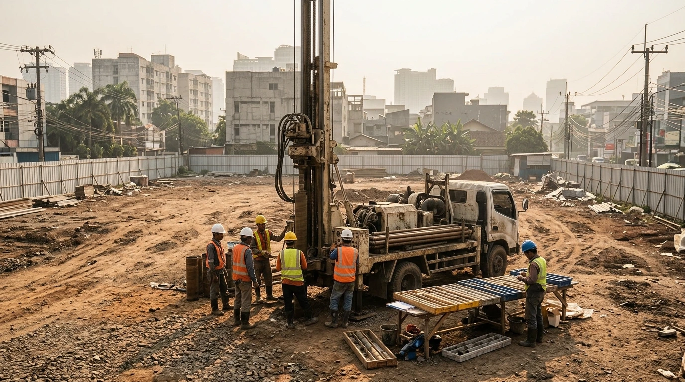
Drilling on a future high-rise site provides the basis for foundation decisions.
What Is Soil Investigation for a High-Rise Building?
Soil investigation (ground investigation) is a combination of fieldwork and laboratory testing that establishes the soil profile, the strength and compressibility of each layer, and the groundwater level at a site. The results are the basis for foundation and excavation design. For a tall building they drive the foundation type, pile depth, and the support strategy for basement excavation.
In Indonesia, SNI 8460:2017 (geotechnical design requirements) is the general reference for geotechnical work, covering foundations, deep excavations, retaining structures, and seismic aspects. It contains a geotechnical data chapter that organises the investigation into preliminary investigation, design-stage investigation, and verification of the investigation results during construction.
On the permitting side, Government Regulation 16/2021 includes soil technical data and soil investigation results in the building approval (PBG) documents. Outreach material on the regulation notes that buildings up to two floors are not required to attach a soil investigation. For a high-rise, those data form part of the technical design documents assessed by the Expert Professional Team (TPA) through a consultation process.
What Goes Wrong When Ground Data Is Inadequate
Design changes and quantity growth
Ground uncertainty almost always turns into numbers. A review by the Institution of Structural Engineers in the UK states that site investigation typically costs about 2% of substructure cost, or roughly 0.1% of total building cost, while ground-related problems account for about one third to one half of construction programme overruns. These figures come from UK building projects, so read them as an indication of proportion rather than a benchmark for Indonesia.
A similar pattern shows up in US research by the National Cooperative Highway Research Program (NCHRP) on road projects: among the most common causes of claims and change orders were pile overruns and groundwater shallower than expected. The context is highways, not buildings, but the mechanism is the same. When early data do not represent the real ground, the difference appears as extra work.
Settlement and tilt
The Millennium Tower in San Francisco is often used as a lesson. The 58-storey tower sits on a mat about three metres thick supported by roughly 940 precast concrete piles. The pile tips are in dense sand at depths of about 15 to 26 metres, while bedrock lies much deeper, more than 45 metres below that sand layer. According to Structure Magazine, settlement exceeded 16 inches (about 41 cm) by 2015 and litigation followed. A foundation upgrade costing about 100 million US dollars was later carried out, adding piles that reach bedrock.
The cause of the settlement is disputed between the parties. The developer pointed to construction of the neighbouring Transit Center, while the Transit Center authority argued that the foundation design, which did not reach bedrock, was responsible. The safe lesson for contractors is not who was right, but that pile-tip bearing depth, the condition of the strata below it, and the influence of nearby construction must be covered by the investigation and monitoring programme from the start.
Seismic loads and site class
Ground data also determine seismic loading. SNI 1726:2019 classifies sites from SA (hard rock) to SF (special soils) based on the soil profile in the top 30 metres, using parameters such as shear wave velocity, SPT N value, or undrained shear strength. Site class SE (soft soil) is characterised by an average N value below 15, among other criteria. Site class SF requires a site-specific geotechnical investigation and site response analysis.
As an illustration, a Diponegoro University final-year project on a hospital building in Semarang computed an average N value of about 11.3 from three boreholes, placing the site in class SE. The example is academic and does not represent every site, but it shows that in coastal areas with soft soils the investigation results directly change the response spectrum the structural designer uses.
Common Soil Investigation Methods
High-rise investigations almost always combine several methods because each answers a different question. A summary follows.
| Method | Indonesian reference | Output | Note for high-rise projects |
|---|---|---|---|
| Deep boring and SPT | SNI 4153:2008 (SPT); SNI 2436:2008 (core drilling record) | Soil profile, N value per depth interval, soil samples | Main basis for the depth of the hard stratum and groundwater level |
| Cone penetration (mechanical sondir/CPT) | SNI 2827:2008 | Cone tip resistance and sleeve friction | Complements boring; equipment capacity can limit depth in dense layers |
| Undisturbed sampling | SNI 03-4148.1-2000 (thin-walled tube) | Clay samples for laboratory tests | Important in soft clays that govern settlement |
| Laboratory tests | e.g. SNI 4813-2015 (UU triaxial), SNI 2812-2011 (consolidation) | Shear strength, consolidation, index properties | Basis for bearing capacity and long-term settlement analysis |
| Pile testing | e.g. SNI 8459:2017 (High Strain Dynamic Pile testing) | Verification of installed pile capacity | Construction-stage verification, not a substitute for the initial investigation |
In the SPT, a sampler is driven into the bottom of the borehole with a 63.5 kg hammer, and the number of blows per penetration interval is recorded as the N value. In Indonesian practice, a hard stratum indication is often defined as a layer with N of about 50 or more over three consecutive layers, as cited in a Diponegoro University journal from the 2021 Ministry of Public Works technical manual on soil testing. Check this definition against the project specification, because each project can set its own bearing criteria.
CPT is strong on continuity because it records ground response continuously, while SPT delivers physical samples that can be inspected and tested. They complement each other, and correlations between SPT N and cone results depend heavily on soil type, so they should not be used as a mechanical conversion.
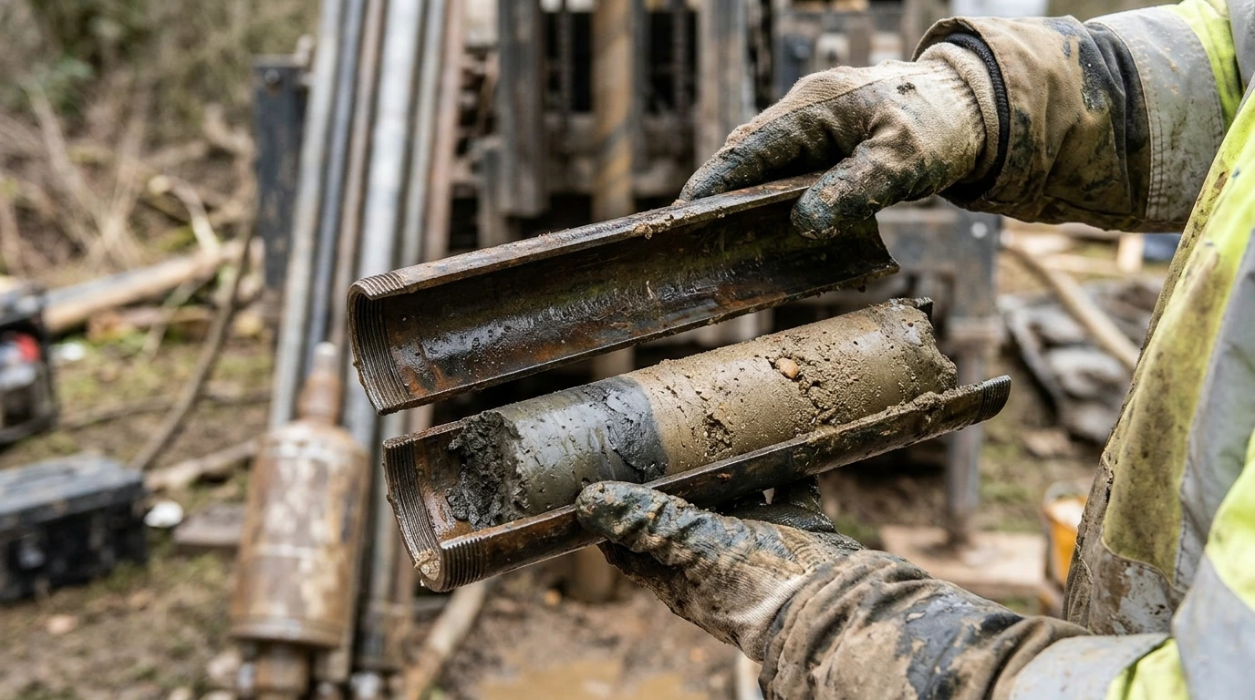
An SPT sampler is opened to inspect the soil recovered from a given depth interval.
How Many Boreholes, and How Deep, for a High-Rise?
The short answer: there is no single number. The number and depth of points depend on plan area and shape, soil variability, foundation type, and load. SNI 8460:2017 directs investigation planning in stages, so the programme is set by the geotechnical engineer and adjusted after the preliminary study.
For comparison, the geotechnical literature gives general guidance, which is not an SNI requirement. It includes at least three boreholes for an area of about 250 m² and about five for about 1,000 m², placed close to foundation positions. For pile foundations the ground should be explored below the pile tips. Eurocode 7 suggests about five pile diameters below the expected toe level. A large pile group in uniform soil is commonly modelled as an equivalent raft at two thirds of the pile length, so the stress influence zone extends below that.
As a regional comparison, a summary of the Singapore Building and Construction Authority (BCA) piling requirements cites at least one borehole per 300 m², spacing of 10 to 30 metres, a minimum of three boreholes, and a depth of 5 metres into a hard stratum with N above 100 or three pile diameters below the tip. Use this only as a comparison, not as a legal reference in Indonesia.
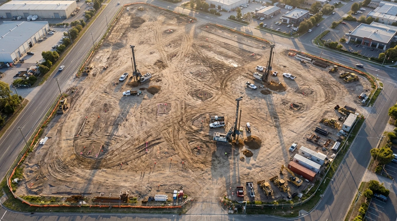
A high-rise investigation is spread across several points on the site plan.
From Ground Data to Foundation Decisions
Once data are collected, the designer selects a foundation system: end-bearing piles on a hard stratum, friction piles, a mat, or a combined piled raft. A Deep Foundations Institute paper on piled rafts for tall buildings describes a process that begins with site characterisation from boreholes to build a subsurface model, then derives foundation parameters from empirical correlations and analyses them in stages. Case studies in the paper report cost and time savings compared with conventional bored pile options.
For contractors this means data quality sets the room for optimisation. Thin data force conservative design. Good data open the door to safe value engineering, for example pile length by zone rather than one length for the whole plan.
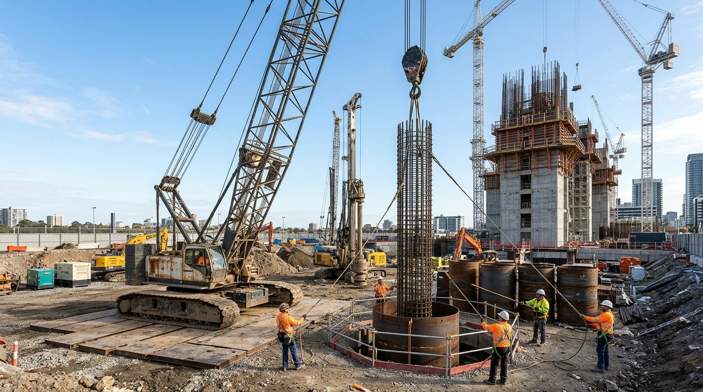
A reinforcement cage is lowered into a bored pile shaft at a high-rise foundation.
Recommended Soil Investigation Procedure
- Desk study. Gather geology, maps, earlier investigation data near the site, site history, and the condition of neighbouring structures.
- Programme design. Set the number, location, and depth of points from the preliminary foundation layout and excavation needs.
- Fieldwork. Carry out boring with SPT, cone tests, undisturbed sampling, and groundwater measurement, with a geotechnical representative supervising directly.
- Laboratory testing. Select tests by soil type and design problem, for example consolidation for settlement-governing clays.
- Interpretation and report. Make sure the report includes the soil profile, design parameters, foundation recommendations, and the limits of the data.
- Construction-stage verification. Compare actual conditions with design assumptions, run pile tests, and adjust if conditions deviate.
Contractor Checklist for Reviewing a Ground Report
- Number and spread of points cover the whole plan, including the core and basement areas.
- Borehole depth passes the planned pile tips with a margin agreed by the geotechnical engineer.
- The bearing stratum is confirmed at more than one point, not a single N reading.
- Groundwater level is recorded with observation dates and seasonal context.
- Borehole logs, cone results, and laboratory tests are consistent with each other.
- Site classification under SNI 1726:2019 is stated with the basis of calculation.
- Foundation recommendations, design parameters, and data limitations are explained.
- Investigation contractor, dates, equipment, and methods are clearly documented.
Common Mistakes to Avoid
The first mistake is cutting the investigation scope to save upfront cost. As the cost proportions above suggest, the saving at this stage is small compared with the risk. Second, treating one borehole as representative of the whole site, when strata can change over short distances. Third, reading a single N value without checking whether that hard layer is thick enough or only a thin lens over softer ground. Fourth, failing to update design assumptions when field findings deviate.
Connecting Ground Data with Design Coordination
Once the ground report is available, the next challenge is making sure all disciplines actually use it. Pile positions, basement excavation depth, retaining walls, utility routes, and neighbouring structures interact. When soil layer data and the foundation layout are shown in one three-dimensional model, clashes between piles, pile caps, basement walls, and underground utilities are easier to see before work starts.
A Building Information Modeling (BIM) approach can support this coordination. Note that BIM does not replace ground investigation and is not automatically required on every project. Its value lies in data integration: results from a competent geotechnical firm can be referenced in the coordination model so that structural, architectural, and MEP decisions rest on the same information.
Conclusion
A tall building transfers very large loads into the ground, so knowing the ground is a prerequisite, not an extra. A well-planned soil investigation combines boring with SPT, cone tests, undisturbed samples, and laboratory tests, with the number and depth of points set by a geotechnical engineer based on SNI 8460:2017 and project conditions. The results drive foundation type, pile depth, the site class for seismic loads, and the room for cost optimisation.
For contractors the most practical step is to review the ground report critically before tender and before mobilisation, use the checklist above, and make sure design assumptions are verified during construction. The cost of an adequate investigation is almost always smaller than the cost of change in the middle of a project.
Preparing or reviewing a high-rise project? Talk with the Fujicon team about your project needs, from how ground investigation data can be referenced in design coordination to a BIM approach that helps avoid clashes between foundations, basements, and utilities. An early discussion helps you frame the right questions for your geotechnical consultant and designers before the foundation decision is locked in.
Fujicon Priangan Perdana
- WhatsApp: +62 811 2227 5222
- Situs web:https://bimsolusi.fujicon.id/
References
- SNI 8460:2017 Geotechnical design requirements, Bina Marga (in Indonesian)
- Outreach material on PBG and SLF under Government Regulation 16/2021 and 28/2025 (in Indonesian)
- Institution of Structural Engineers, geotechnical risk paper
- Structure Magazine, Millennium Tower
- Dezeen, Millennium Tower
- Undip civil engineering journal, site classification (in Indonesian)
- Undip final project, SPT-based site classification (in Indonesian)
- Undip journal, deep boring and hard stratum definition (in Indonesian)
- Structville, number and depth of borings
- BCA Singapore, piling requirements summary
- Deep Foundations Institute, Economic Foundation Design for Tall Buildings