

Mine Sites Keep Changing: Is Your Data Still Accurate?
As an illustration, imagine a planning team opening a work map to set this week's excavation target. In the field, excavators have already moved a large amount of material, the mining front has shifted, and a new stockpile has formed elsewhere on site. The map on screen may still show conditions from some time ago.
This situation is familiar in open-pit operations. Excavation, material movement, stockpiling, and the opening of new areas can reshape a mine surface in a short time. These changes are not always visible from the office, yet they affect elevation, slope, and the geometry of work areas.
This is where mine topographic data matters. Topographic data records the shape and height of the ground surface at a specific time. When it is not updated, a gap can open between actual field conditions and the data used for planning, from volume estimates to haul road design.
This article covers why mine conditions change, the risks of outdated data, survey and mapping technologies, how to assess accuracy, and how to choose a partner. Timely topographic updates are more than a surveyor's concern; they are an important part of decision making based on actual field conditions.
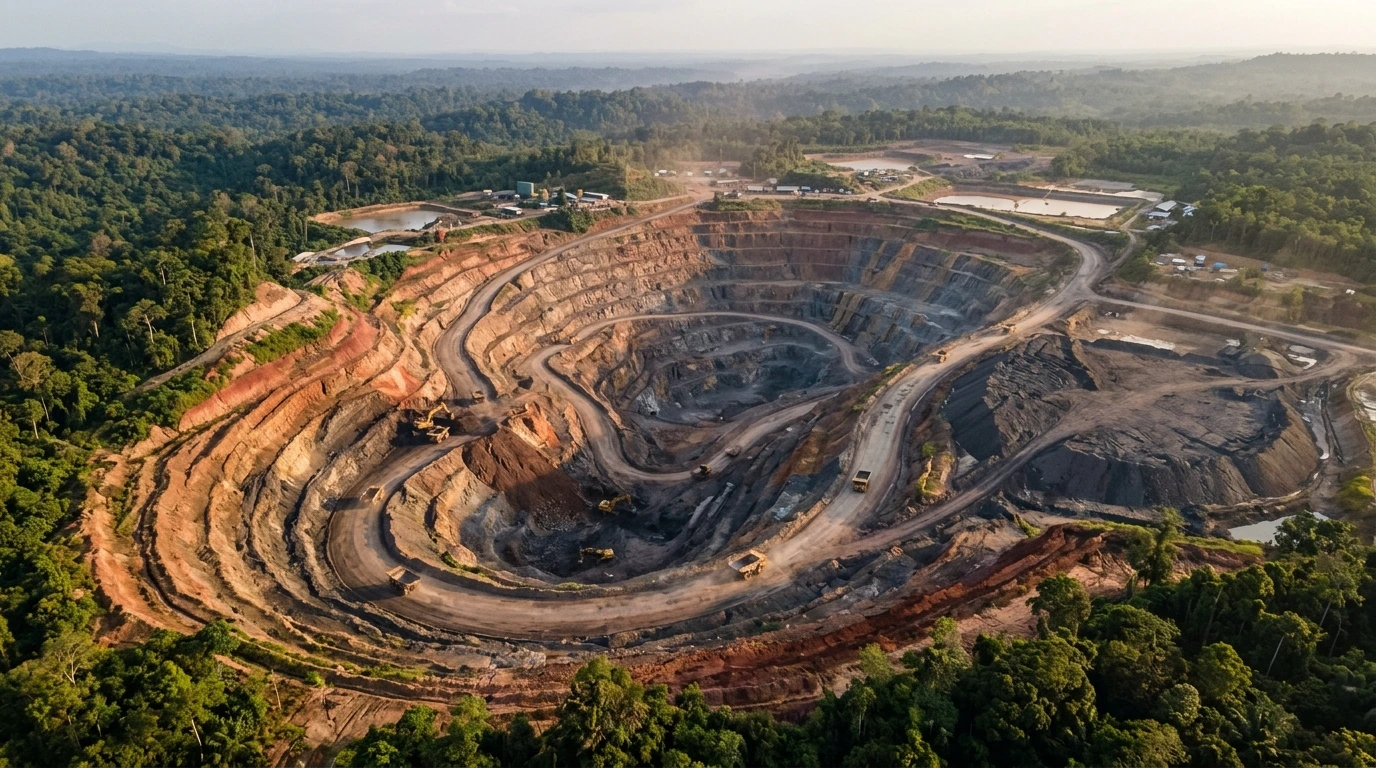
Caption: Excavation and stockpiling can change a mine's surface contours in a short time.
Why Do Mine Site Conditions Change So Quickly?
Mine conditions change quickly because operations reshape the ground surface every day. Excavation lowers elevation, stockpiling raises it, and both can run at the same time across many locations.
The main factors behind changes in mine topography are listed below.
Excavation and movement of the mining front
Excavation forms mine benches (bench), which are stepped terraces cut gradually into the slope. The mining front, the area currently being excavated, moves with the production plan, so bench geometry changes with it.
Material stockpiling and waste dump
Overburden that is not processed is placed in a waste dump, a stockpile area. Its shape and height grow as material is hauled in, so its elevation and volume need to be monitored.
Haul roads, facilities, and area expansion
Haul roads (haul road) are relocated or built anew as the front moves. Supporting facilities and newly opened areas also change elevation and the direction of surface water flow.
Drainage and natural factors
Changes in drainage, rainfall, erosion, and ground movement can alter land conditions even where no heavy equipment is working.
Each of these changes affects the data needed for mine planning, volume measurement, work supervision, and field evaluation.
| Change in the field | Data need affected |
|---|---|
| Excavation and front movement | Mine planning and progress evaluation |
| Stockpiling at the waste dump | Stockpile volume measurement |
| Haul road changes | Work supervision and road geometry design |
| Drainage and land surface changes | Field condition evaluation |
Illustrative example (not a real event or a case study of any company): a stockpile area receives material from several dumping points, and its toe widens toward a drainage channel. If planners still use an old surface model, volume calculations and channel plans may not match actual conditions.
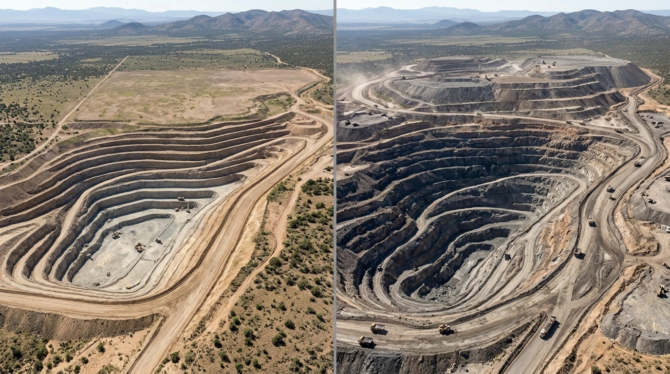
Caption: Illustration of a mine surface changing over time in the same area.
Risks of Using Outdated Topographic Data
Topographic data that no longer reflects actual conditions can create mismatches across many parts of mine work. The risk is not always large, but it can accumulate when differences go undetected.
Risks to watch for include:
- Mismatch between plans and the field. Bench or work-area plans are drawn on a surface that has already changed.
- Errors in excavation and stockpile volume estimates. Volume depends on the difference between two surfaces; if one is outdated, the result shifts.
- Inaccurate progress calculations. Progress evaluations may not match actual work done.
- Difficult coordination between teams. Survey, planning, and operations may work with different data versions.
- Haul road and facility design mismatches. Road geometry or facility locations may be designed without the latest elevations.
- Delayed decisions. Unplanned resurveys postpone decisions that could have been made sooner.
- Operational risk. Insufficient information on elevation and work-area geometry can affect field operations.
The level of risk depends heavily on site characteristics, work methods, data quality, and the control procedures in place. Topographic data alone cannot guarantee mine safety. Safety still requires geotechnical evaluation, operating procedures, monitoring, and competent personnel.
In Indonesia, good mining engineering practice is governed in part by Minister of Energy and Mineral Resources Decree No. 1827 K/30/MEM/2018. Internal requirements and the regulations applicable at your site remain the primary reference.
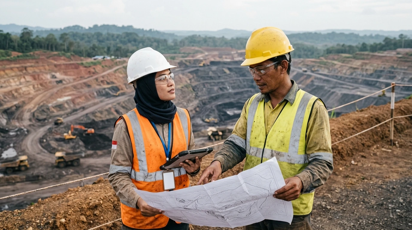
Caption: Verifying data against field conditions supports better technical decisions.
What Is Topographic Data and Why Does It Matter for Mines?
Topographic data describes the horizontal position and elevation of points on the ground surface so that terrain shape can be represented in a measurable way. In mining, it is the basis for planning, volume measurement, work supervision, and documenting site conditions at a given time.
Topographic data elements relevant to mines include:
- Horizontal coordinates and elevation, the foundation of every other data product.
- Contour lines, which connect points of equal elevation and show the shape of the surface.
- Digital Terrain Model (DTM), a model of the bare ground without objects on top of it.
- Digital Surface Model (DSM), a model of the top surface, including objects above the ground.
- Three-dimensional point cloud, a set of points with X, Y, Z coordinates from measurement or image processing.
- Orthomosaic, an aerial image corrected geometrically so it can be used for planimetric measurement.
- Surface models and planning support data, for example the comparison of two surfaces to derive volume.
DTM versus DSM
| Aspect | DTM | DSM |
|---|---|---|
| What it shows | Ground surface (bare earth) | Top surface, including vegetation, buildings, and material |
| Example uses | Road design, ground contour evaluation, drainage analysis | Documenting actual surface conditions, monitoring material stockpiles |
| Points to watch | Non-ground objects must be filtered out | May contain temporary objects, such as heavy equipment |
The choice of data product depends on the survey purpose, terrain characteristics, engineering needs, and required accuracy standard. For that reason, data requirements should be defined before the survey method is chosen.
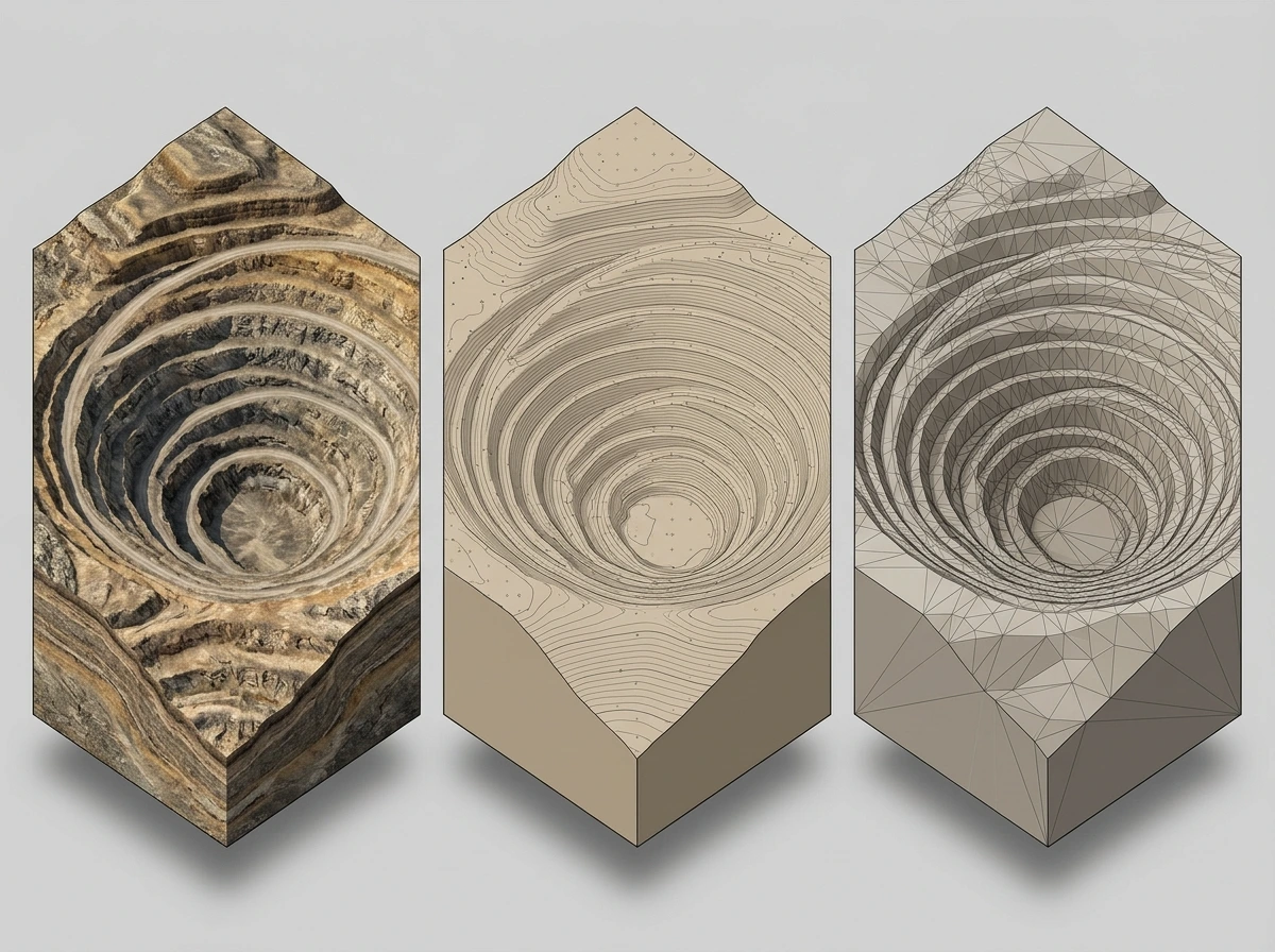
Caption: Topographic data can be presented as contours, elevation points, or a three-dimensional model.
Technologies for Obtaining Accurate Topographic Data
No single technology is always best in every condition. The method is chosen based on project needs, required accuracy, area size, accessibility, field risk, time, and budget. These are the survey and mapping technologies commonly used in mining environments.
A. GNSS RTK
GNSS (Global Navigation Satellite System) determines position from satellite signals. With RTK (Real-Time Kinematic), corrections from a reference station are sent in real time to the receiver in the field, so position can be refined while measuring.
The method is commonly used for control points and field detail. Results are affected by sky obstruction, signal reflection (multipath), satellite geometry, distance to the reference station, and the quality of the correction link.
B. Total Station
A total station measures angles and distances electronically from a single setup point to a target. It suits detailed mapping and work that needs controlled observation, especially where the sky is obstructed or where measurements must be tied to clear control points. Measurement requires a line of sight between instrument and target.
C. Drone Photogrammetry
Photogrammetry uses overlapping aerial photos. Processing software turns them into an orthomosaic, a point cloud, and a surface model. Its strengths are wide area coverage in a relatively short time and visual documentation of field conditions.
Limitations to consider include weather, vegetation covering the ground, image-capture geometry, availability of control points, and the need to validate accuracy with check points.
D. LiDAR
LiDAR (Light Detection and Ranging) emits laser pulses and measures the time they take to return, producing a three-dimensional point cloud. Sensors can be mounted on aerial platforms or ground-based equipment. In certain terrain, LiDAR can be useful for obtaining detailed surface data.
The ability to penetrate vegetation, the level of detail, and data quality depend on the system used and on measurement conditions. Requirements and specifications should therefore be confirmed before choosing the method.
E. Data Integration with GIS and Digital Models
Survey data is processed, visualized, compared over time, and integrated into geographic information systems (GIS) or digital modeling workflows. This integration helps teams compare surfaces from two dates, measure change, and prepare data for further planning.
Quick Comparison
| Technology | Main output | Considerations |
|---|---|---|
| GNSS RTK | Control points and field detail | Depends on open sky and corrections |
| Total station | Measured detail points from angles and distances | Needs line of sight; coverage per setup is limited |
| Drone photogrammetry | Orthomosaic, point cloud, surface model | Affected by weather, vegetation, and control points |
| LiDAR | Detailed 3D point cloud | Quality depends on the system and measurement conditions |
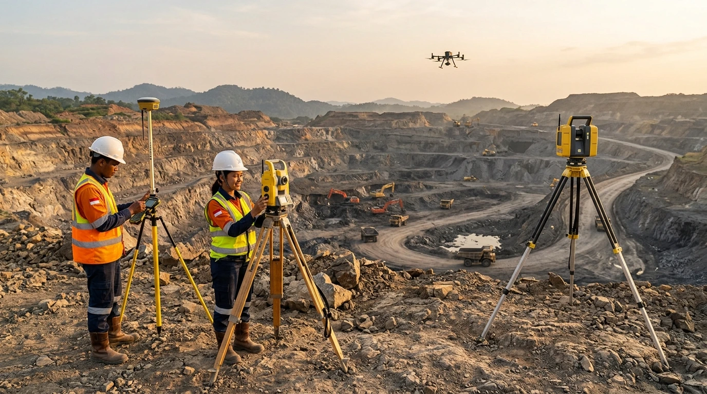
Caption: Survey methods are chosen according to project needs, terrain, and required accuracy.
How Accurate Does Topographic Data Need to Be?
Required accuracy is set by the purpose of the work, technical requirements, and the consequences of error, not by one universal number. Accuracy also cannot be judged from image resolution, point count, or instrument specifications alone.
Spatial resolution describes how fine the visible detail is, for example pixel size. Positional accuracy describes how close measured coordinates are to true values. High-resolution data can still be positioned wrongly if its control points are poor.
Factors that determine data quality:
- Precision of instruments and measurement methods.
- A consistent coordinate system and vertical datum.
- Quality of control points and calibration procedures.
- Data capture geometry and terrain conditions.
- Density and distribution of measured points.
- Data processing and filtering methods.
- Validation with independent check points.
- Documentation of results and measurement uncertainty.
As references, standards such as the ASPRS Positional Accuracy Standards for Digital Geospatial Data set out how to report the accuracy of digital geospatial data, and in Indonesia the Geospatial Information Agency (BIG) publishes technical guidelines on base map accuracy. Mine requirements must still be set by data users and project technical specifications.
- The survey date is recorded and suits the decision at hand.
- The coordinate system and vertical datum are clearly stated.
- Control points and the method used to tie to them are documented.
- Independent check points exist, with validation results.
- Processing and filtering methods are explained.
- Uncertainty or accuracy limits are reported.
- Model versions and file names are consistent.
- The intended use of the data matches the survey scope.
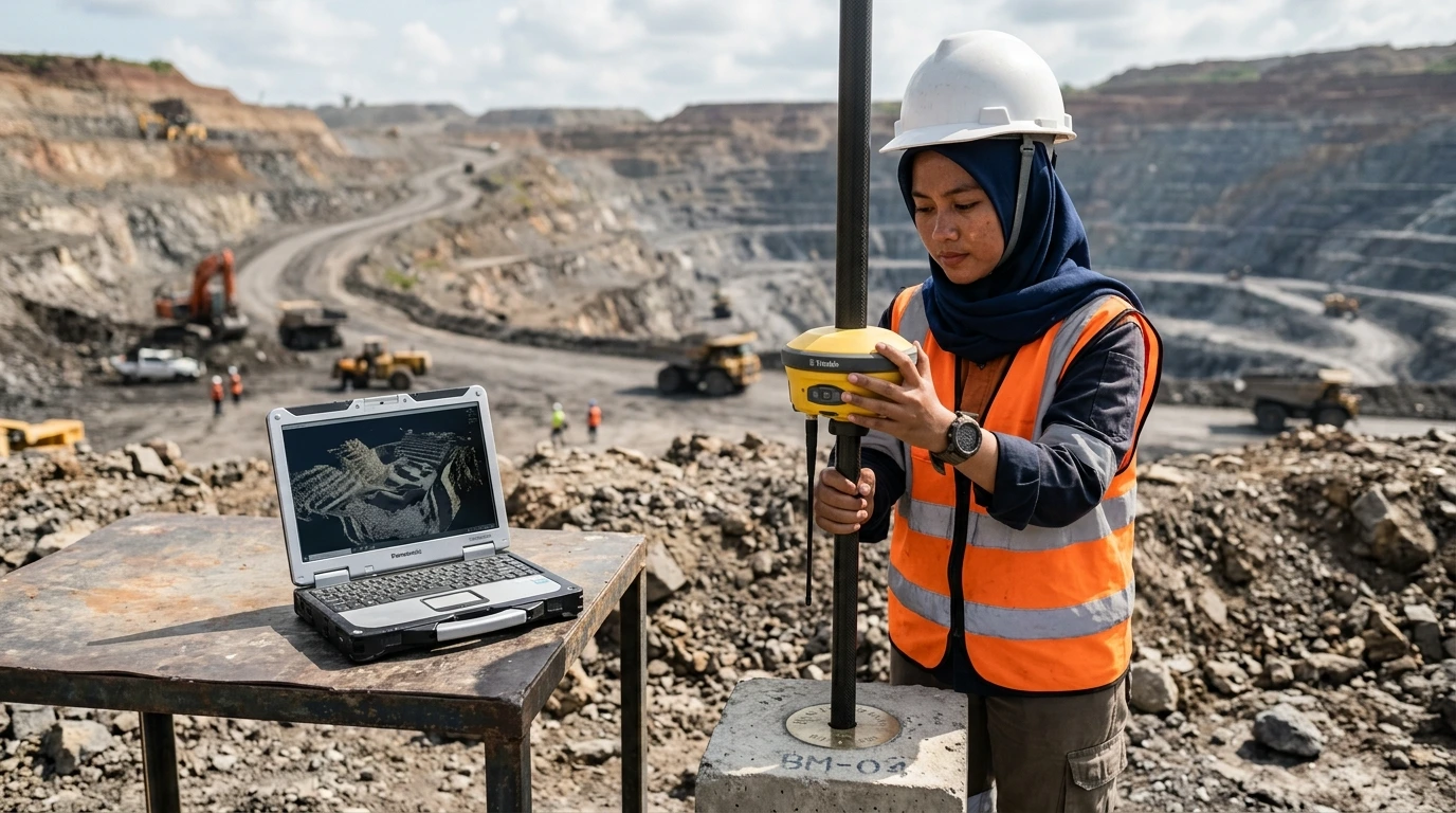
Caption: Control points and check points help validate the accuracy of topographic data.
How Often Should Mine Topographic Surveys Be Updated?
No single update frequency applies to every mine. The need for updates depends on how fast field conditions change and what the data is used for.
Factors that influence update needs:
- Intensity of excavation and stockpiling.
- Speed at which area geometry changes.
- Size and complexity of the operating area.
- Need for volume calculations.
- Stage of mine planning and execution.
- Risks linked to changing field conditions.
- Internal company requirements and applicable regulations.
In practice, updates can be designed around three complementary approaches.
| Approach | When to use it | Illustrative example* |
|---|---|---|
| Scheduled updates | Changes are fairly regular and need periodic monitoring | A survey at a fixed period agreed by the team |
| Updates triggered by significant change | A major change occurs at the front, stockpile, or haul road | A survey after opening a new area or relocating a road |
| Special surveys | A specific measurement need arises | A survey for volume calculation at the end of an evaluation period |
*These examples are illustrations only and not mandatory intervals. Schedules must be adjusted to operational needs, internal requirements, and applicable regulations.
A periodic monitoring cycle generally runs as follows:
- Define the area and the purpose of monitoring.
- Collect field data with a suitable method.
- Process the data and update the surface model.
- Validate results and compare them with the previous survey.
- Distribute the latest data to relevant teams.
- Review the need for the next survey.
IMAGE POSITION 7 — Periodic Topographic Monitoring (delete this box after the image is placed)
Purpose: Depict the cycle from data capture to updating the surface model.
Prompt (EN): Photorealistic image of an Indonesian mine survey team of one man and one woman (the woman without hijab, hair tied back under her safety helmet), with realistic Indonesian facial features and natural Southeast Asian skin tones, in a field vehicle bay preparing a small survey drone beside a laptop, open-pit mine in the background at a later stage of excavation than a printed reference plan visible on the vehicle hood, helmets and high-visibility vests, medium-wide shot, soft morning light, realistic details, documentary photography shot on a full-frame camera, realistic skin texture, 16:9, no logos, no readable text, no watermark.
Negative prompt: cartoon, readable text, brand logos, watermark, unsafe behavior, exaggerated futuristic effects, illustration, 3D render, CGI, painting, non-Indonesian facial features, caricature or stereotyped faces.
Specification: 16:9 ratio.
Alt text: Survey team preparing a drone near a mine site for a topographic data update.
Caption: Regular data updates keep the surface model consistent with field conditions.
From Field Data to Ready-to-Use Information
A mine topographic survey and mapping job generally goes through the following ten steps.
- Identify the survey purpose and user needs.
- Choose the data collection method.
- Prepare the coordinate system and control points.
- Acquire field data.
- Process and clean the data.
- Build the topographic model and derived products.
- Check quality and validate results.
- Prepare the report and hand over the data.
- Integrate with the relevant teams' working systems.
- Update the data as operations require.
Accurate data needs documentation so it can be traced and used correctly by planning and operations teams. At minimum, documentation covers metadata, consistent file naming, survey date, coordinate system, model version, and data quality notes.
Without this information, two teams can use files that look identical but come from different dates or coordinate systems.
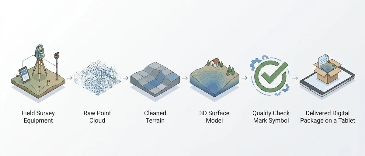
Caption: Field data is processed, validated, and documented before delivery.
Benefits of Accurate Topographic Data for Mine Operations
Accurate, up-to-date topographic data gives different teams the same information base. Benefits include:
- Mine planning and progress evaluation. Front position and bench geometry can be compared with the plan.
- Cut and fill volume calculation. Volume comes from the difference between two surfaces at different dates.
- Contour change monitoring. Changes between periods can be observed and documented.
- Haul road and infrastructure planning. Geometry is designed with the latest elevations.
- Team coordination. Survey, planning, and operations teams work from the same data.
- Documentation of site conditions at a given time.
- A basis for further technical analysis.
- Decisions based on more current data.
A realistic usage example: at the end of an evaluation period, the planning team compares the starting and ending surface models to calculate cut and fill volumes, then reconciles them with production records. If a difference appears, the team can trace its cause through metadata and validation reports.
Good data is not the prettiest data; it is the data that matches the field as it is today.
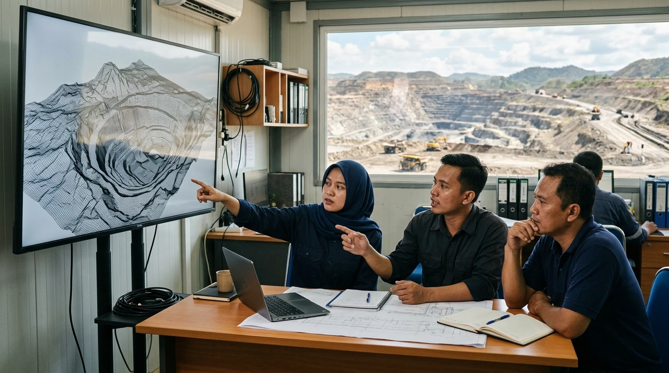
Caption: An up-to-date surface model supports discussion and decisions grounded in field conditions.
Choosing a Survey and Mapping Partner for Mining Needs
The quality of topographic data depends heavily on who designs, collects, processes, and documents it. A partner is therefore worth assessing on technical grounds, not on price alone.
Criteria to consider:
- Understanding of mining technical needs, including how planning and operations teams use the data.
- Fit between methods and technology and field conditions and work objectives.
- Quality control and validation procedures, including the use of check points.
- Personnel competence and equipment readiness.
- Ability to manage data and documentation, from metadata to model versions.
- Clear scope of work and deliverables.
- Ability to coordinate with the project team.
- Compliance with applicable safety requirements and regulations.
For companies that want to discuss survey, mapping, and digital solutions including BIM, Fujicon Priangan Perdana is available as a discussion partner. An initial conversation helps identify the data purpose, site conditions, required data products, and the accuracy standard expected before a method is chosen.
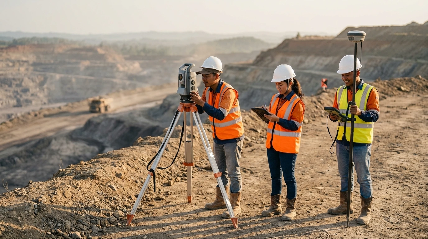
Caption: Well-planned, safety-conscious surveys support reliable data.
Conclusion: The Right Decisions Start with Accurate Topographic Data
The main messages of this article can be summarized as follows:
- Mine sites can change quickly.
- Outdated topographic data can create mismatches in analysis and planning.
- Survey technology should be chosen to suit the site and the purpose of the work.
- Accuracy must be verified, not merely assumed.
- Consistent data updates and documentation support better decisions.
If you need to discuss topographic surveys, mapping, field data updates, or digital solutions that fit your mining project, contact our team for an initial discussion.
Fujicon Priangan Perdana
- WhatsApp: +62 811 2227 5222
- Website: https://bim.solusi.fujicon.id
References
- Minister of Energy and Mineral Resources Decree No. 1827 K/30/MEM/2018 on Guidelines for Implementing Good Mining Engineering Practice (in Indonesian)
- Geospatial Information Agency (BIG) Regulation No. 6 of 2018 on Technical Guidelines for Base Map Accuracy (in Indonesian)
- ASPRS Positional Accuracy Standards for Digital Geospatial Data